Philip's Big Easy to Read Scotland Road Atlas (Spiral A3): All the detail you need at a size you can read
(Spiral bound)
Publishing Details
Philip's Big Easy to Read Scotland Road Atlas (Spiral A3): All the detail you need at a size you can read
By (Author) Philip's Maps
Octopus Publishing Group
Philip's
11th November 2025
7th August 2025
United Kingdom
Classifications
General
Non Fiction
Travel maps and atlases
Road atlases and maps
Physical Properties
Spiral bound
96
Width 285mm, Height 394mm
Description
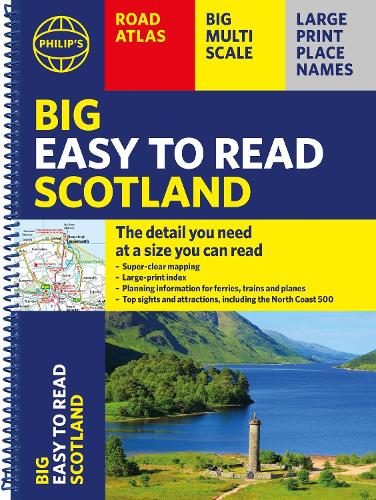
Philip's Big Easy Read Scotland Road Atlas is an exceptionally clear guide to the best of Scotland from the market-leading map makers. Reliable and up to date, the fully indexed mapping is accompanied by town plans, tourist and planning information, and spectacular scenic routes including the celebrated North Coast 500. The detailed yet easy-read maps show national parks, cultural and historical attractions, long-distance footpaths and much, much more.
Exceptional clarity with large-print place names and large-scale maps Large-print index Super-sized A3 pages for easy reading on the go Shows most of Scotland at a scale of 1 inch to 2.37 miles (1:150 000); most islands and north Scotland at 1 inch to 3.16 miles (1:200 000) and 1 inch to 3.95 miles (1:250 000) Packed with ideas and details about places to visit Easy to read mapping with the NC500, long-distance footpaths, national parks, museums, castles and more Town centre maps, fully indexed for easy navigation Clear travel-planning information - trains, planes and ferries Hard-wearing and practical A3 format with spiral bindingAuthor Bio
Philip's has been at the forefront of creating maps and atlases since 1834. Whether a local street map or a fact-packed World Atlas, we use the most up-to-date technology, expertise and our global network to ensure our customers have all the information they need.
