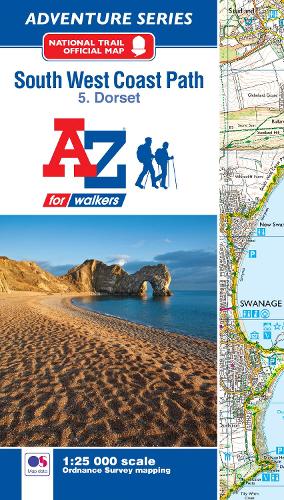
SW Coast Path Dorset Adventure Atlas
(Paperback, 2nd Revised edition)
Publishing Details
SW Coast Path Dorset Adventure Atlas
HarperCollins Publishers
Geographers' A-Z Map Co Ltd
31st January 2024
12th April 2018
2nd Revised edition
United Kingdom
Classifications
General
Non Fiction
912.4233
Physical Properties
Paperback
52
Width 134mm, Height 240mm, Spine 8mm
107g
Description
The A-Z Adventure series features the accuracy and quality of OS 1:25000 mapping in a convenient book, complete with index.
An innovative concept, the A-Z Adventure series utilises Ordnance Survey 1:25000 mapping in a book, therefore eliminating the need to fold and re-fold a large sheet map to the desired area. OS 1:25000 is Ordnance Survey's most detailed mapping, showing public rights of way, open access land, national parks, tourist information, car parks, public houses and camping and caravan sites.
Unlike the original OS sheets, this A-Z Adventure Atlas includes a comprehensive index to towns, villages, hamlets and locations, natural features, nature reserves, car parks and youth hostels, making it easy to find the required location quickly. Each index entry has a page reference and a six figure National Grid Reference. At a book size of 240mm x 134mm it is the same size as the standard folded OS map.
The South West Coast Path is a National Trail along the Somerset, Devon, Cornwall and Dorset coasts. This stunning walk from Minehead, Somerset covers 630 miles to South Haven Point in Poole Harbour, passing through two World Heritage Sites (the Jurassic Coast and the Cornwall and West Devon Mining Landscape), Exmoor National Park, Land's End and many areas of outstanding natural beauty.
This A-Z Adventure Atlas of the SW Coast Path Dorset features 36 pages of continuous Ordnance Survey mapping covering the SW Coast Path from Lyme Regis, following the route east, to its finishing point at South Haven Point in Poole Harbour. The alternative shorter route along the South Dorset Ridgeway is also shown. Clearly highlighted in yellow, to stand out from the many other footpaths, the path is easy to identify. In addition mileage markers have been introduced to the map making it easy to gauge distances when planning your own sections of the walk to enjoy.
A route planner providing the distances between places and the amenities available, featuring:
Information Centres
Visitor Centres
Hotels/B&Bs
Youth Hostels
Campsites (seasonal opening)
Public Houses
Shops
Restaurants
Cafes (seasonal opening)
Petrol stations
Also featured is a selection of QR codes linked to useful websites.
The South West Coast Path is covered by the following five titles in the A-Z Adventure series:
SW Coast Path North Devon and Somerset
SW Coast Path North Cornwall
SW Coast Path South Cornwall
SW Coast Path South Devon
SW Coast Path Dorset
Author Bio
Geographers' Map Company Ltd. (A-Z Maps) was established in London on 25 August 1936. The company's most famous publication, the iconic A-Z Atlas and Guide to London, was created by Phyllis Pearsall, the founder of A-Z, who explored every street in London to create the first edition. Since then, A-Z has become the trusted source for street maps and atlases, as well as developing Visitors' Guides, Road Atlases and the Adventure Map series for walkers.
